

Community Design
Why should we plan for active community design
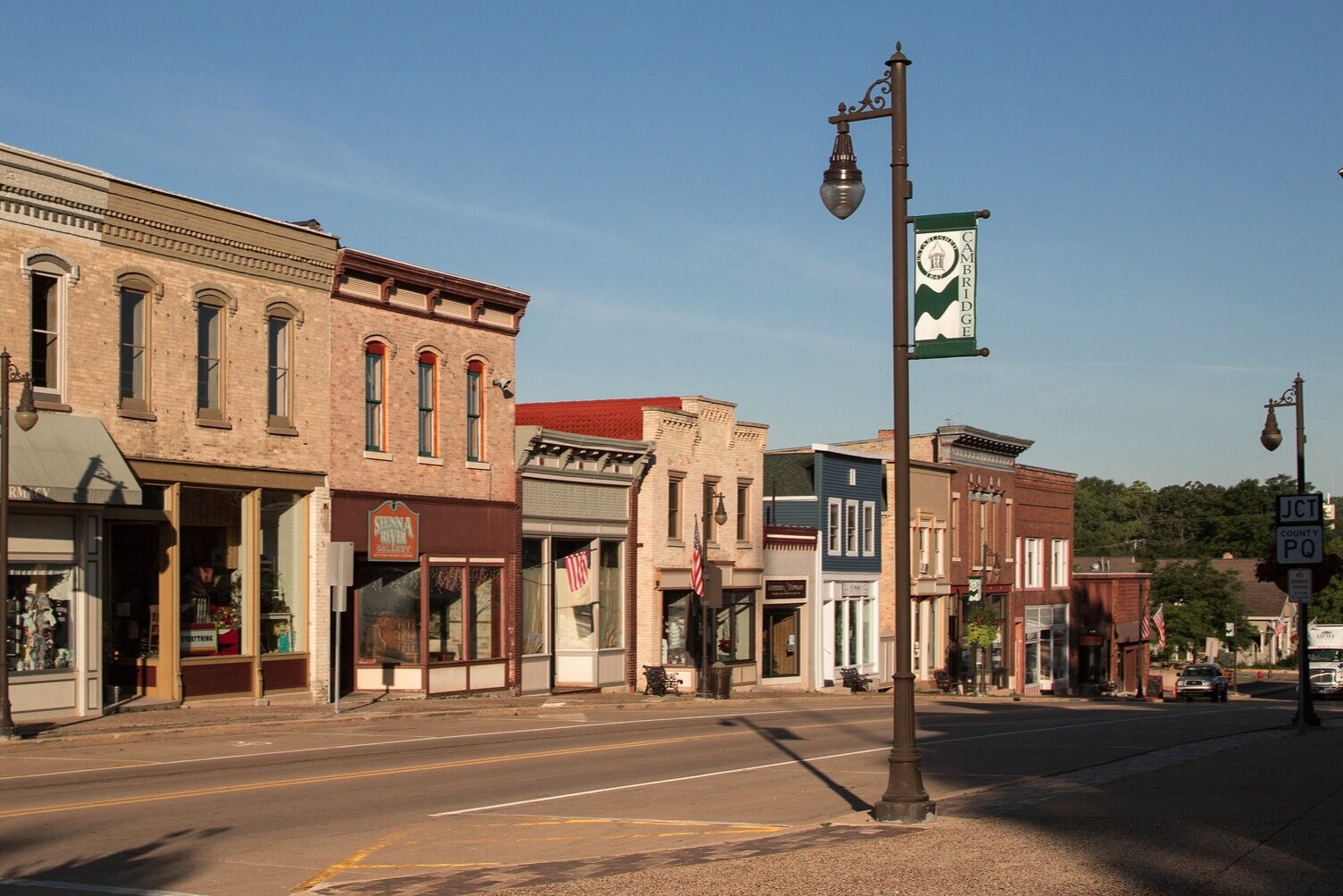
Planning for health involves more than providing healthy food and places to be active. The whole design of the community should make walking, biking, and taking transit convenient options. Compact, mixed-use development is the most effective way to do this.1-3 Buildings should be close together or clustered. Homes and businesses should be in the same area instead of separate. That way, daily activities like grocery shopping and going to work are only a walk or bike ride away from home.
In addition, planners can make sure that paths and streets form a grid with many connections. This provides many options for walkers and bicyclists. It allows them to avoid major roadways. Street patterns like this encourage people to walk and bike where they need to go.2,4 When we combine mixed land use, compact development, and grid street patterns, we can encourage everyday physical activity.4
best practices for urban & Suburban Comprehensive Plans
Click the plus sign (+) to see more information about that best practice.
+ Support walkable, mixed-use development
- Recommend actions that make mixed-use development attractive to pursue. Examples include:
- Mixed-use zoning
- Incentives such as density bonuses and location-efficient mortgages
- Collaboration with transportation agencies
+ Support connected street networks in mixed-use areas that are pedestrian-friendly
- Sets policy goals for well-connected street networks built to a human scale with one or more of the following features:
- Appropriate block lengths that promote safe walking
- Principal functional building entries on front façades that face a public space, such as a street, park, or plaza
- Building entries at frequent intervals along streets and sidewalks
- Ground-floor retail in nonresidential and mixed-use projects
- Clear glass façades for ground-level retail, service, or trade uses
- Limited blank walls along building façades
- Ground-level retail, service, and trade windows visible and unshuttered at night
- Covenants, conditions, and restrictions, or other deed restrictions, to ensure the maintenance of visible/unshuttered windows along ground-level retail, service, or trade uses in perpetuity
- Elevated finished floors for ground-floor residential units
- Minimized exposure to parking lots
- Minimized exposure to active driveways
- Wider sidewalks in mixed-use areas
- Elimination or reduction of building setbacks to create a sense of enclosure for pedestrians
- Active uses at ground floor
- Building-height to street-width ratio that maintains a walkable streetscape
- Buildings oriented to face the street or civic spaces
+ Set a goal or objective to promote compact development to promote livability, walkability, and transportation efficiency
- Identify at least one strategy for achieving this goal. Examples include:
- Increasing density for mixed-use development where infrastructure is in place
- Transfer of development rights with designated receiving areas
+ Set a goal or objective to promote transit-oriented design
- Identify appropriate locations and standards for transit-oriented design in collaboration with the DOT and/or provide incentives such as density bonuses for development in these locations.
+ Support Traditional Neighborhood Development, or village-style development
- Identify ideal locations, setting standards for TND or village-style development and/or provide incentives such as density bonuses for development in these locations.
+ Support infill and redevelopment of greyfields in areas already served by public infrastructure
- Set specific goals for infill and redevelopment of greyfields. Examples include:
- Inventorying targeted areas
- Providing incentives for their development or redevelopment
+ Set a goal or objective to repurpose, adapt, and reuse older buildings rather than demolishing them and/or constructing on greenfields
- Identify targeted areas for these efforts.
+ Support connectivity between developments
- Require connectivity between residential and neighborhood-style commercial development.
+ Support accessory dwelling units in appropriate locations to create affordable options in existing communities and foster social cohesion for older citizens, young people just starting out, and others who can’t afford or don’t want to live in a single-family dwelling
- Set specific policies, goals, and/or standards for permitting accessory dwelling units in appropriate locations.
+ Set a goal or objective to promote “third places” and public spaces.
- Examples of “third places” include:
- Walkable main streets
- Coffee houses
- Plazas
- Promenades
- Play fountains
- Outdoor cafes
- Pubs
- Bookstores
- Other public gathering spots with seating
+ Set a goal or objective to use street trees for shade and to enhance walkability
- Create specific goals for street trees, including size, spacing and species.
+ Set a goal to promote natural surveillance techniques that make walking safer, like orienting buildings to face the street and including windows that face the street
- Recommend specific guidelines or requirements for the orientation of buildings and placement of windows.
+ Support recognized third-party standards for healthy building design and operations, such as Leadership in Energy and Environment Design (LEED)
- Incentivize specific building rating systems that promote healthy building measures such as clean indoor air, active occupants, daylighting, and healthy food options.
+ Support recognized third-party standards for sustainable, healthy mixed-use communities such as STAR Communities or LEED for Neighborhood Development
- Incentivize specific community rating systems that promote healthy eating and active living such as walkability, bicycle facilities, connectivity, access to outdoor recreation, social cohesion, safety, healthy food access, and indoor air quality.

Traditional neighborhood developments provide a range of housing types, walkable and connected streets, and amenities like stores and schools. Photo: Hercules, CA. Credit: Eric Fischer.

Accessory dwelling units can help create affordable housing and build density. Photo: Alberta, Portland, OR. Credit: Christy Cassano-Meyer, found on accessorydwellings.org.

“Third places” like plazas and coffee shops provide space for the community to come together. Photo: The Terrace, Madison, WI. Credit: Richard Hurd.
Best Practices for Rural Comprehensive Plans
Click the plus sign (+) to see more information about that best practice.
+ Identify activity hubs such as schools, historic downtowns, parks, or commercial centers and prioritize economic development in those areas
- Set specific policy goals for encouraging growth in designated areas. Strategies include:
- Remove barriers or create incentives for mixed-use or higher-density development
- Transfer of development rights
- Expedited development review
- Lower development fees
- Property tax abatements
- Impact fees priced according to distance from designated activity hub
- Reduced or eliminated minimum lot sizes
+ Promote residential development in designated growth areas
- Define designated growth areas within or adjacent to areas already served by existing infrastructure.
- Set specific policy goals for encouraging growth in desginated growth areas. Examples inclue:
- Remove barriers or create incentives for mixed-use or higher-density development
- Transfer of development rights
- Expedited development review
- Lower development fees
- Property tax abatements
- Impact fees priced according to distance from designated growth area
- Reduced or eliminated minimum lot sizes
+ Set a goal or objective to improve the aesthetics of activity hubs to make them centers of pedestrian activity
- Identify strategies for achieving this goal/objective. Examples include:
- Create a local business improvement district (BID)
- Implement a Main Street Program
- Use form-based codes
- Form partnerships with local businesses
- Identify vacant or historic buildings and rehabilitate them
+ Support co-location of services in activity hubs, especially in schools
- Work with relevant state, regional, or local agencies to locate community services in existing or new activity hubs. Examples of services include:
- Senior centers
- Public libraries
- Wellness centers
- Public meeting spaces
- Government offices
+ Set a goal or objective to make walking and biking safer, more convenient, and more comfortable within activity hubs
- Identify specific design strategies for improving pedestrian safety and comfort, such as:
- Crosswalks, pedestrian signals, and/or crossing guards
- Traffic-calming measures like medians, narrowed lanes, and/or bump-outs
- Reduced speed limits
- Bike amenities
- “Share the Road” signs
- Pedestrian-oriented streetscape features like planters, lighting, and benches
+ Support infill and the repurposing, adaptation, and reuse of older buildings rather than demolition and new construction on greenfields
- Identify target areas for infill and reuse.
- Provide incentives for redevelopment.
+ Set a goal or objective to support “conservation subdivisions” or “rural home clustering” in which homes are built on smaller lots and open space is set aside for recreation and conservation
- Create design guidelines, set specific policy goals, and/or identify areas particularly appropriate for rural home clustering.
+ Set a goal or objective to preserve existing working farms and other natural resource businesses as preferable to low-density sprawl
- Set specific policy goals for the preservation of working farms and natural resource businesses, such as:
- Right-to-farm ordinances
- Transfer of development rights ordinances
- Required buffers between agricultural operations and residential development
- Lot size minimums in agricultural areas
- Purchase of development rights programs
- Taxing agricultural land at current use value instead of highest real estate market value
- Conservation easement programs
Business Improvement Districts and Main Street Programs can help improve the aesthetics of historic downtowns. Photo: Downtown Loveland, OH. Credit: J. Stephen Conn.
In a conservation subdivision design, lots are smaller and land is set aside for conservation and recreation. Photo credit: landchoices.org.
Preserving working farms helps reduce suburban sprawl. Photo: Vernon County, WI. Credit: Darrin.
Resources
EPA’s Smart Growth best practice guides and case studies, by topic:
Main Street America: National program that works to revitalize older and historic commercial districts to build vibrant neighborhoods and thriving economies.
Wisconsin Economic Development Corporation’s Main Street Program: Wisconsin chapter of Main Street America program. Provides technical assistance to communities in the planning, management, and implementation of strategic development projects in downtowns and urban neighborhoods.
UW Extension’s Local Government Center resources on Business Improvement Districts: Educational information, programs, and related materials on implementing business improvement districts in Wisconsin.
LEED’s Local Government Guide for Neighborhood Development: Guide for local governments to use the LEED for Neighborhood Development rating system to achieve sustainability goals.
LEED’s Technical Guidance Manual for Sustainable Neighborhoods: Guide to evaluate and amend local plans, codes, and policies in order to promote sustainable communities.
Southwest Wisconsin Regional Planning Commission’s Conservation Subdivision Design Process: Step-by-step guide for implementing conservation subdivisions.
Land Choices resources on Conservation Subdivisions: Examples, guidebooks, and motivation for implementing conservation subdivisions.
Project for Public Spaces: Resources for creating and sustaining public spaces that build stronger communities.
ChangeLab Solutions’ Building In Healthy Infill: Strategies for and examples of infill development policies.
American Planning Association’s Resources to plan for accessory dwelling units (ADUs).
Mobilize for Health Community Design Strategy Menu: Summary of evidence for community design strategies with implementation resources and examples from Wisconsin communities.
REFERENCES
Mackenbach JD, Rutter H, Compernolle S, et al. Obesogenic environments: a systematic review of the association between the physical environment and adult weight status, the SPOTLIGHT project. BMC Public Health. 2014;14(1):233.
Kärmeniemi M, Lankila T, Ikäheimo T, Koivumaa-Honkanen H, Korpelainen R. The Built Environment as a Determinant of Physical Activity: A Systematic Review of Longitudinal Studies and Natural Experiments. Annals of Behavioral Medicine. 2018;52(3):239-251. doi:10.1093/abm/kax043
de Vet E, de Ridder DTD, de Wit JBF. Environmental correlates of physical activity and dietary behaviours among young people: a systematic review of reviews: Environmental correlates of overweight among youth. Obesity Reviews. 2011;12(5):e130-e142. doi:10.1111/j.1467-789X.2010.00784.x
Community Preventative Services Task Force. Physical Activity: Built Environment Approaches Combining Transportation System Interventions with Land Use and Environmental Design.; 2016. https://www.thecommunityguide.org/findings/physical-activity-built-environment-approaches.